You are here
How the Journal Investigated Hidden Lead Cables Circling the U.S.

![]()
Two lead-sheathed telephone cables are abandoned under a railroad bridge crossing Lake Pend Oreille, Idaho.
Photo: AMI VITALE for The Wall Street Journal
The Wall Street Journal collected data on thousands of toxic lead cables crisscrossing the U.S., some abandoned for decades by the nation’s largest telecom companies.
How did the Journal figure this out? The phone companies aren’t required to disclose this information and both federal and state environmental agencies have largely been unaware of the risk. A team of reporters, with the help of experts in the field, used among other things a pile of ancient permits, machine-learning algorithms and an instrument called an X-ray fluorescence analyzer.
The Journal began with cables that run beneath many of the nation’s waterways. The Journal filed public-records requests with the U.S. Army Corps of Engineers and its various district offices, seeking permits—some more than a century old—from companies in the Bell System, which dominated phone services across the U.S. from the late 1800s until its 1984 breakup.
Army Corps staffers went through thousands of permit files, including old paper records. In a bid to fill gaps in the records, the Journal also requested permits from 30 states and from the U.S. Bureau of Reclamation.
Journal reporters wrote code to process these records and built a database to store them. Reporters used software to clean up the scans of the decades-old permits and make the text searchable.
Using the written description of the cable’s location and the hand-drawn maps attached to most of the permits, Journal reporters located the latitude and longitude center points of these cables in waterways. The Journal identified about 1,700 permitted underwater cables this way. Additionally, the Journal received coordinates from government authorities for nearly 90 underwater cable permits in spreadsheets or maps. Some records were less precise.
Hunting for permits
The bulk of permits were from the 1940s through the early 1960s. Journal reporters included only pre-1965 permits and records, which was when the Bell System phased out its use of lead, unless later permits referenced earlier cables that weren’t present in the database.
Many permits referenced locations near each other. The Journal clustered together cables within roughly one-third of a mile for some of its analyses.
The Journal obtained detailed maps of water bodies from the U.S. Geological Survey and created a computer program that would find the shortest path across the water that passed through the center point of each cluster to approximate the likely path of the cable from bank to bank.
To determine whether underwater cables were inside drinking-water sources, the Journal sent the identified locations to the Environmental Protection Agency. EPA water specialists reviewed the locations and estimated that roughly 330 were in a Source Water Protection Area, which means it provides drinking water. The EPA didn’t identify which specific locations were in Source Water Protection Areas, citing their sensitivity.
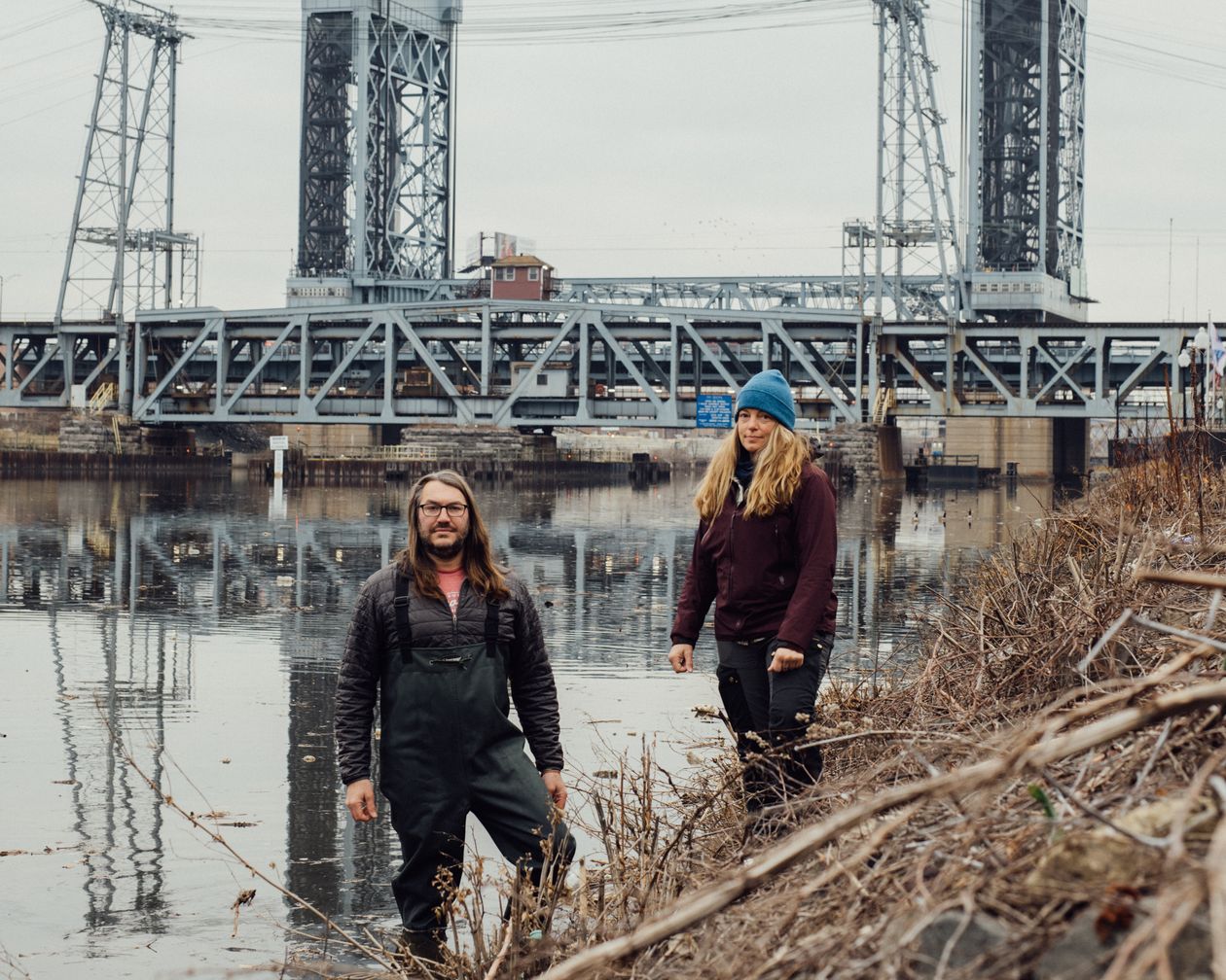
Seth Jones and Monique Rydel Fortner of Marine Taxonomic Services, seen here by the Passaic River in New Jersey, helped the Journal collect water samples.
Photo: George Etheredge for The Wall Street Journal
This database of underwater cables represents just a fraction of those laid by telecom companies. Army Corps officers said many permits were likely lost or discarded over the years, and while many Army Corps offices returned hundreds of permits, some returned only a handful or none at all. It is possible some of the permits are inaccurate, incomplete or that some portion of the cable was damaged or removed in subsequent years. The Journal also identified more than 450 aerial cable locations, most of which run next to streets–hanging over schools, bus stops, parks and homes.
Google and an algorithm
The Journal extracted images from Google Street View in front of each school in the nation’s five densest states and 16 of the 20 densest counties. In New Jersey, the nation’s most-densely populated state, the Journal also pulled images of a random sample of nearly 10,000 NJ Transit bus stops.
The Journal trained a machine-learning algorithm to detect if there were lead cables in those images. Reporters manually reviewed all the examples where the algorithm flagged lead cabling.
Bryan Stolte, a certified industrial hygienist and workplace safety expert, who has worked for AT&T
and other telecom companies in environmental engineering, reviewed a sample of the images and confirmed the validity of the analysis.
In total, the Journal’s automated computer systems analyzed nearly 100,000 images, and reporters manually reviewed every one the algorithm identified as featuring lead-covered cables.
These aerial cables almost certainly reflect a small part of the lead strung up on telephone poles across the country.
Journal reporters added other data sets to figure out whether lead cables were in places where children often congregated, given their heightened vulnerability. The research firm MCH Strategic Data—which specializes in educational, healthcare and government data—provided the Journal with a snapshot of the location of schools and daycare centers in the country. The Journal used data from some state education departments and locations of parks nationwide from mapping software company Esri.
Journal reporters accompanied research divers, university scientists and environmental consultants around the country to examine the lead-sheathed cables. Journal reporters found cables, or evidence of them, in nearly every site visit—including the bayous of Louisiana, under bridges in New Jersey, in southwestern Pennsylvania and in the panhandle of Idaho. The Journal consulted with more than two dozen experts and academics to review the findings and verify the methodology used.
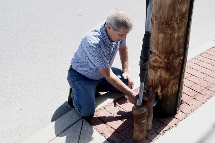
Jack Caravanos used an X-ray fluorescence analyzer to test the ground next to lead infrastructure in Wappingers Falls, N.Y.
Photo: John West/The Wall Street Journal
In collecting samples from water, soil and sediment, researchers from environmental-consulting firm Marine Taxonomic Services, which assisted the Journal, sought to ensure accuracy and avoid contamination. All coolers used for sample collections were cleaned and rinsed with deionized water before being used. The sampling team wore nitrile gloves, which members changed whenever they collected multiple samples. Geolocation data was recorded at sampling sites. Samples were preserved with nitric acid before being analyzed by Pace Analytical Services, an independent accredited laboratory that provides environmental testing services.
In collecting deep-water samples next to cables, divers descended slowly to the cable in order not to disturb sediment, and collected the water sample 1 centimeter from the cable using a clean plastic syringe. Samples from shallow water were collected 1 centimeter from the cable. The sampling experts used procedures to avoid contamination. Plastic sample containers were provided by Pace Analytical. In some cases, the divers also tested at further distances from cables.
Sediment and soil samples were collected using clean stainless-steel scoops. These samples were collected up to 15 centimeters from cables, and doubled bagged. Lead-cable scrapings were taken and double bagged after soil and water sample collections were completed.
Jennifer Hoponick Redmon, a senior environmental health scientist at RTI International, an independent nonprofit research institute, provided technical support and guidance to the Journal on lead testing and its health effects. RTI also paid about $1,700 for some lab tests at the project’s outset.
Gordon Binkhorst, an environmental consultant and expert on lead sampling, reviewed the sampling methods used by the Journal and said they were appropriate techniques for testing for lead in the soil and water near the cables, using a certified environmental testing lab.
Visiting cable locations
The Journal visited about 300 cable sites and collected roughly 200 environmental samples at nearly 130 of those places. Seth Jones and Monique Rydel Fortner at Marine Taxonomic Services discovered the underwater cables in Lake Tahoe more than 10 years ago, alerted the public and advocated for their removal, but aren’t a party to a lawsuit that led to AT&T agreeing to remove two cables from the lake.
They assisted the Journal in site visits, collecting the samples—sometimes through scuba diving—and tabulating the data. Tom Neltner, a lead expert at the nonprofit Environmental Defense Fund, provided guidance to MTS. The EDF also provided $85,000 to MTS to partly fund its field research for the project.
The Journal used several methods to connect the lead found in soil and water to the cables. It collected “background” samples at various distances from the cables to test the naturally occurring lead levels. A higher lead reading closer to the cables indicated they were likely the cause of the contamination, experts said.
The Journal sent several sets of samples to Bruce Nelson, a University of Washington professor of geochemistry who runs a lab that performed what’s called an isotopic analysis of the samples, which links the lead from the cable to the lead in the ground and water.
This procedure uses an instrument called a mass spectrometer, which measures the four common atomic masses that constitute lead, giving it a specific fingerprint.
Nelson determined that samples selected by the Journal from cables in New Iberia, La., Coal Center, Pa., and Lake Pend Oreille, Idaho, indicated that the likely source of contaminating lead was from the local cable. Nelson also measured the fingerprints of background lead in the soil, and found those fingerprints to be different from those of the lead in the soil at the cable site.
The Journal also used an X-ray fluorescence analyzer, which can measure lead in the soil. The lead contamination was highest directly beneath or next to cables, and fell sharply within a foot or two away, indicating the cable was the likely cause, according to data collected by New York University environmental public-health professor Jack Caravanos, who measured lead in the soil in New York, New Jersey and Louisiana.
ome samples were collected, dried, blended, sieved and tested at NYU. Daily calibration checks were done to ensure instrumental accuracy.
Caravanos computed the potential increases in blood lead levels found in children using an EPA model called the Integrated Exposure Uptake Biokinetic Model for Lead in Children. Quest Diagnostics
advised the Journal on analyzing blood-test data nationwide.
The Journal determined that lead cables could leach by sending lead samples from the cables to Complete Environmental Testing, an environmental-testing lab, which did an EPA test known as the SPLP, or Synthetic Precipitation Leaching Procedure, to determine that the lead was leachable.
For some sites, the Journal also used an analysis known as the TCLP test, or the Toxicity Characteristic Leaching Procedure, which indicated that the levels of lead were above a threshold set by the EPA to be potentially handled as hazardous waste.
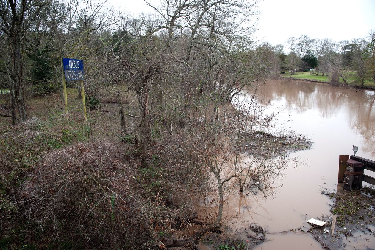
A cable crossing sign next to Bayou Teche outside New Iberia, La.
Photo: Rory Doyle for The Wall Street Journal
Write to John West at john.west@wsj.com, Coulter Jones at coulter.jones@wsj.com, Susan Pulliam at Susan.Pulliam@wsj.com, Shalini Ramachandran at Shalini.Ramachandran@wsj.com and Thomas Gryta at Thomas.Gryta@wsj.com
Corrections & Amplifications
An earlier version of this article didn’t include information about the financial contributions made by two groups. RTI International paid about $1,700 for some lab tests at the project’s outset. The Environmental Defense Fund provided $85,000 to Marine Taxonomic Services to partly fund its field research for the project, which involved collecting water and soil samples.